A Need for Good Data
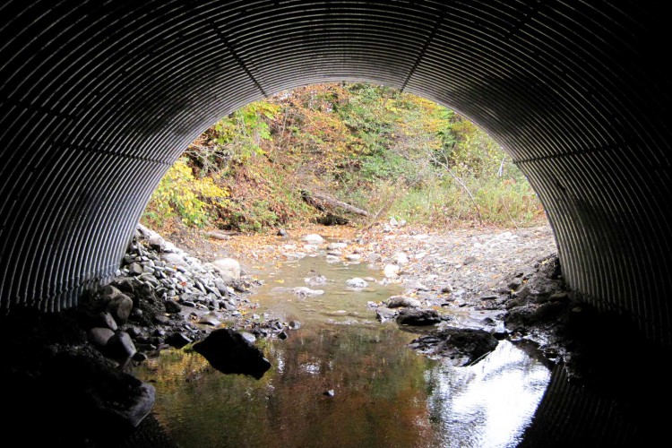
 Culverts provide a means for water to flow beneath roadways and other structures while minimizing erosion damage. Culverts also allow fish to move to waters that are better suited to the season (warmer in winter, cooler in summer) and allow for genetic flow between otherwise separated populations. Yet if they are improperly sized or configured, culverts can limit movement by aquatic organisms and increase flood risk. In order to predict risk to animals and the built environment, planners need good data about whether culverts are sized and configured appropriately.
In 2013, The Nature Conservancy hired Redstart to conduct a watershed-wide culvert assessment in the Lamoille River watershed. The main goals were to assess culverts for aquatic organism passage (AOP) and for geomorphic compatibility. The Vermont chapter of the Nature Conservancy, working in conjunction with the Vermont Department of Fish and Wildlife, had prioritized this watershed for assessment based on the high habitat value and the lack of data regarding aquatic organism passage through culverts.
A Comprehensive Assessment
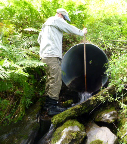
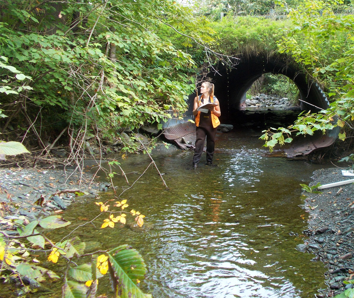
Using a comprehensive assessment protocol developed by Vermont Fish and Wildlife, equipped with projected locations from a geographic information system model and carrying handheld GPS units and data collection sheets, Redstart staff, lead by Dan “Rudi” Ruddell, assessed over 1,250 culverts in the Lamoille Watershed. Culvert by culvert, the team took measurements and assessed suitability for fish passage and potential flood risk and potential impact.
 After taking this data, Redstart entered it into the statewide data management system, worked it through a quality assurance and quality control process. Redstart then created summary reports that identified the highest priority culverts for retrofit and replacement for each town in the Lamoille watershed. Subsequently, Redstart worked with The Nature Conservancy to draft outreach materials that were used in meetings with towns and regional planning commission staff to encourage culvert replacement and retrofit.
A Significant Impact
As is often the case, the data commissioned by the Nature Conservancy and gathered in the field by Redstart was just a first step, yet it has made a significant impact. In the town of Eden, for example, Redstart identified two culverts along a tributary of Haynesville Brook that were blocking fish passage and increasing flood risk. In 2015, the culverts were replaced by a team that included personnel from Vermont Department of Environmental Conservation, Caledonia County Natural Resources Conservation District, US Fish and Wildlife Service, Vermont Agency of Transportation, Vermont Department of Fish and Wildlife, and the town of Walden. Similar teams are now working to plan additional culvert projects in other areas of the Lamoille watershed. Meanwhile, Redstart is working with partners to conduct culvert assessments in other parts of Vermont.